On a bit of a dull morning my son and I decided to do a linear walk from the tiny hamlet of Braidley in Coverdale to Kettlewell in Wharfedale. Scaling the heights of Little Whernside at 604 meters high and Great Whernside, 704 meters, two meters higher than Buckden Pike! Just over eight miles, quite strenuous in places but enjoyable none the less.
As you go along you can begin to see the reservoirs in Nidderdale, Scar House coming into view first and then Angram reservoir. Penhill can been seen and at one point Pen-y-Gent came into view.
If you have someone who can drop you off in Braidley and then pick you up in Kettlewell all to the good, or some such configuration, as there was very little parking in Braidley. There is a little green where we managed to sneak into the last parking space, one of about six or eight spaces available. The road is so narrow there was nowhere to park on the side of the road either. The journey from Kettlewell to Braidley is interesting enough and you can see where you will be walking for most of the route.
Please do plan your route beforehand, it isn’t complicated but still needs looking at and wear appropriate clothing and good boots. I should imagine it can get quite wet and boggy in places so perhaps it’s best to walk this route after a good dry spell as we did.
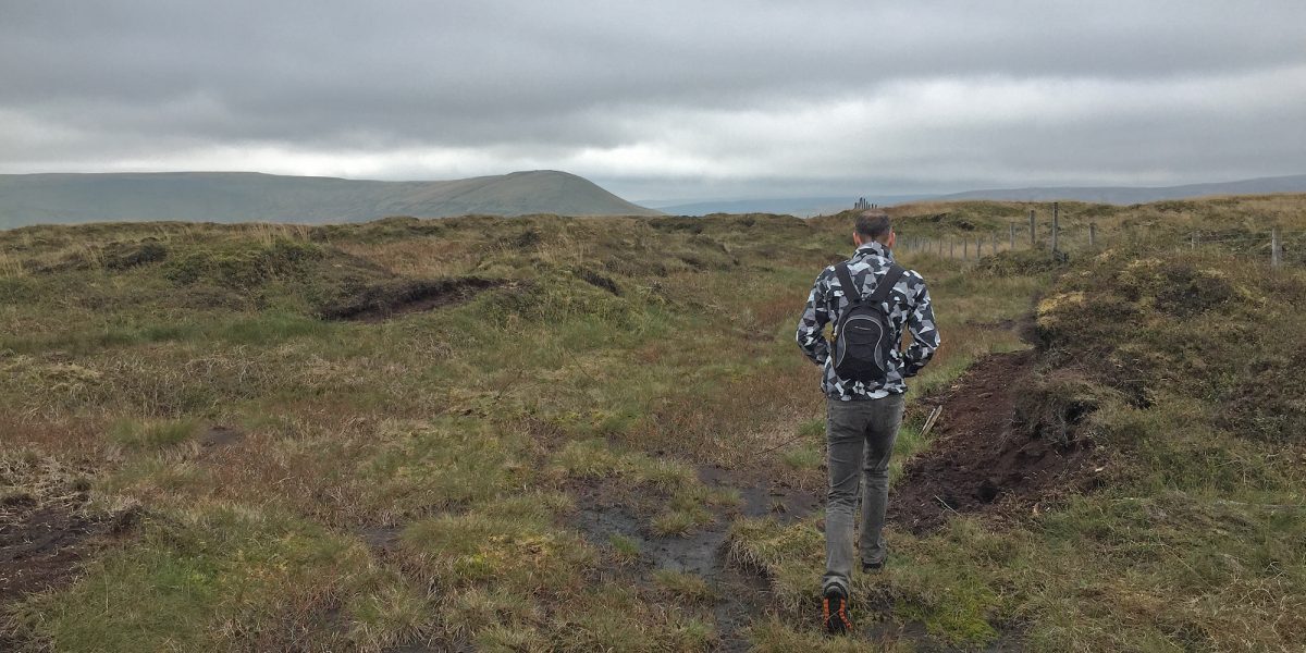
Anyway, togged up with lots of layers and plenty to eat and drink we set off on our little expedition. Take the footpath to the south west of the village, remembering to go off to the east when you approach the River Cover, feels a little strange as you can see Little Whernside and you’re walking in the wrong direction but soon there is a foot bridge to cross over and your climb begins. A steady pull to the top, keep going, that’s all you can do but do stop, if like me you need a breather, and enjoy the views unfolding. Once to the wire fence with Little Whernside on your right, again off to the left to the stile a few yards away and then turn right, east then west. I said to Paul, one hill done, two more to go and how right I was!
Now you can see the route in front of you, press on over Little Whernside, down again and then it’s up again to the top of Great Whernside. I had no idea how big Great Whernside was, thought it was just hump as you look from the Coverdale side but no its stretches quite a way going south to the cairn and then east. There are lots of rocks strewn about at the top so be careful, quite a surprise after such a barren moor landscape. At the cairn it’s time to descend and the sun is beginning to appear! There is a well worn path to follow, more or less west, after a fair descent there is a short stretch which is quite steep and has loose stones but carefully does it and you’ll be fine. (I mention this as I’m not the best on steep uncertain terrain!) You’re more or less at Hag Dyke now and here you have a choice of paths but we took the most direct route past Hooksbank and eventually into Kettlewell. Considering it was so cold on the tops long before we reached Kettlewell we were down to T-shirts, a lesson to always be prepared. Ready for an ice cream, food, drink? You’ll find places in Kettlewell to be sure.
Come and stay in one of cottages and enjoy this route. Call me, Nadine, or my daughter Joanne, on 01969 663559 for friendly help and advice or do book online if you wish. We hope to hear from you soon!

Written By Nadine Bell


)